Remote sensing
Remote sensing describes the acquisition of information about the earth surface without making physical contact. Sensors can be handheld or mounted on drones, aircrafts, and satellites. We use remote sensing to understand where, when and why forests are disturbed, how they recover after disturbance, and how disturbances shape forest structures and functions. Our remote sensing data are the basis for manifold research projects and applications.
Laser scanning
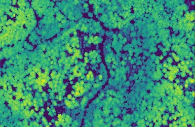
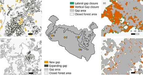
Using laser scanning data we model forests in 3D to understand how environmental drivers and disturbances shape the structure of trees and forests. We acquire laser-scanning both on the ground and from the air, i.e., with planes, helicopters and drones. One allows us to quantify how branches and leaves grow in space at centimetric resolution, the other to survey the landscape-scale mosaics of forests and disturbed patches over hundreds of square kilometres. Beyond one-off snapshots, we harmonize data into large collections and precisely track how ecosystem structure changes across environmental gradients, variable land uses, and in time. This reveals patterns and processes difficult to assess using classical field observations alone, as shown in a study of canopy gaps in Berchtesgaden (see Figure below).
Optical sensors
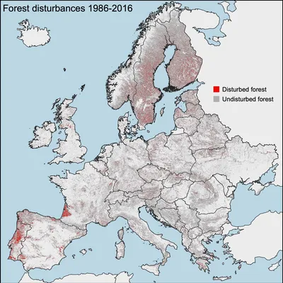
We use a wide range of optical sensors to monitor ecosystems at scale. In the field, we use automatic camera traps to monitor animal populations and manual photography for the rapid assessment of disturbance legacies. With repeat acquisitions of airborne photography, we reconstruct decadal changes in land cover and infer changes in forest disturbance and recovery of entire regions such as Bavaria. Based on satellite-based spatially explicit maps on forest disturbances, pioneered in our group and further developed by our collaborators, we monitor canopy changes caused by various agents of change, including harvest, windthrow, fire and bark beetle. The maps are freely available for use (https://doi.org/10.5281/zenodo.7080016) and can be explored online.
Widening the horizon
Our data and maps complement and extend local field measurements to large scales and over long time periods. They thus serve as input to a wide range of applied research and management projects, including the modelling of wildlife habitats, the assessment of natural hazard risks, the management of forest resources, and the design of protected areas. We also provide seamless and harmonized data to other researchers who want to combine their field data with the broad-scale view offered by remote sensing. If you are interested in collaborating, do not hesitate to contact us!